Marina and Adjacent Town Illustrated Map
Illustration and design: John Potter; Escape Key Graphics
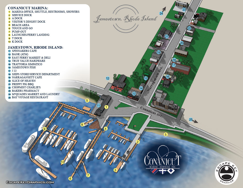
This map focuses in on downtown Jamestown and the marina docks and facilities more. This map should be a great aide to sailors making landfall at the marina. This map gives a clear overview of dock arrangements, restaurant locations and local conveniences.
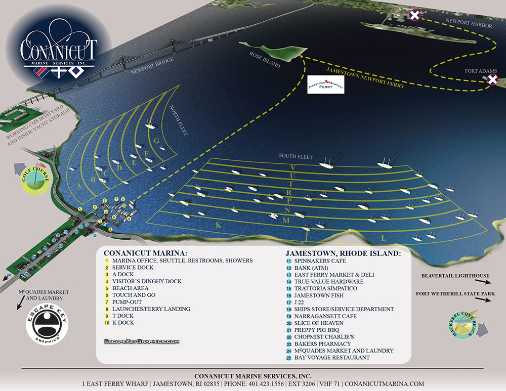
This map is a broad view map showing everything from Newport Harbor to the west side of Jamestown and The Newport Bridge to pretty far south. It’s a good tool for general orientation and locating areas within the vast mooring fields operated by Conanicut Marina. It also gives a pretty good overview of the Jamestown/Newport Ferry.